

residential surveys.
Map & Survey employs highly experienced staff and consultants with expertise in the following land development areas:

CAD PRESENTATION
Standard Survey CAD Drafting
Lease plans
Marketing plans
3D Shadow Diagrams
Exported into a variety of formats
and more

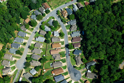
LAND DEVELOPMENT
Complete subdivision service including Detail and Level surveys, boundary control survey, road calculations and design, lot calculations and preparation of subdivision plan for lodgement at Lands Title Office.
Project Management, negotiations with government authorities, subdivision service designs, calling of tenders, preparation and letting of contracts, site and contract supervision, coordination of contractors and service authorities.
Commissioning and coordinating specialist reports including geotechnical reports, contamination assessments and remediation, flora and fauna assessments and species impact.
TOWN + REGIONAL PLANNING
Urban and regional design
Impact of Planning and Assessment Act 1979 on proposed developments and review of environmental factors
Initial site feasibility study and discussion with authorities
Large Topographic (Detail and Level) surveys
Preparation and submission of Development Applications to council

MARKETING PLANS
House Floorplans
Commercial Floorplans
Subdivision Layout

DESIGN SERVICES
Road / Driveway
Landscape
Drainage
Plan printing
Plan copying